![]()
![]()
![]()
![]()
![]()
![]()
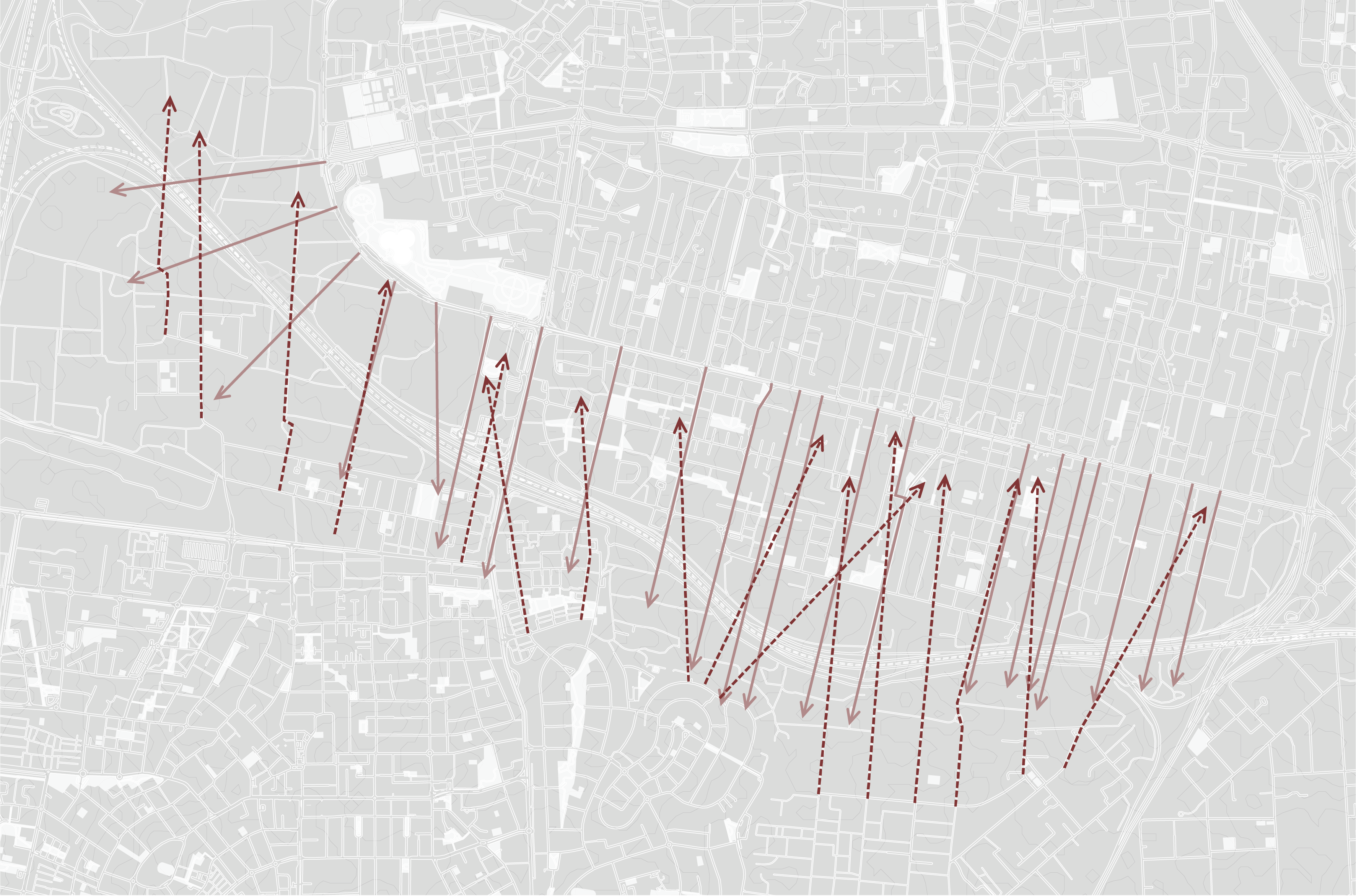
Israel’s rapid population growth has led to unrestrained urban sprawl and to the acceleration of suburbanization processes. Meanwhile, the central business district in Gush Dan has continued to grow, resulting in increased commutes and dependence on private cars. These processes have led to a significant expansion of transportation infrastructures, which is reflected in the growing number of both roads and vehicles. Private car dependency causes far-reaching spatial implications as a result of road paving. These include taking over green spaces, damaging ecological systems, creating urban barriers, and creating visual obstructions. Despite the physical connections that roads create on a national scale, the way they meet spaces on a human scale introduces a phenomenon of separation due to their linear nature. In addition, their spatial layout creates a continuous space of suburbs “fortified” by asphalt and acoustic walls.
The project encourages a renewed look at how transportation infrastructures meet urban spaces and seeks to respond to the phenomenon of separation roads create. It examines the architecture of the road, its linearity and the space it creates, in order to find opportunities for intervention. The project aims to change the space in a way that weakens the road’s place in the spatial hierarchy and to obscure its unequivocalness, both morphologically and programmatically. The project perceives the road as a “wound” in its surroundings and tries to heal the damaged urban fabric.
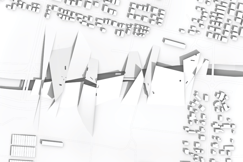
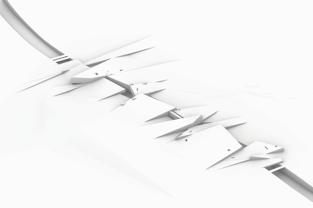
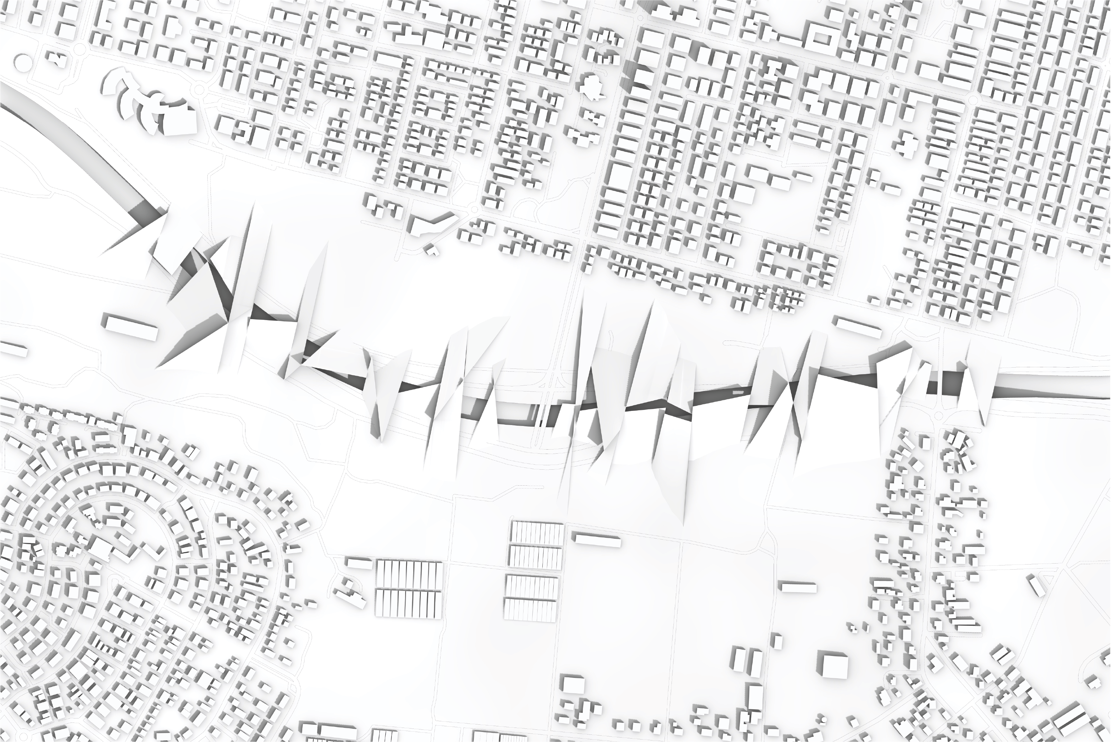
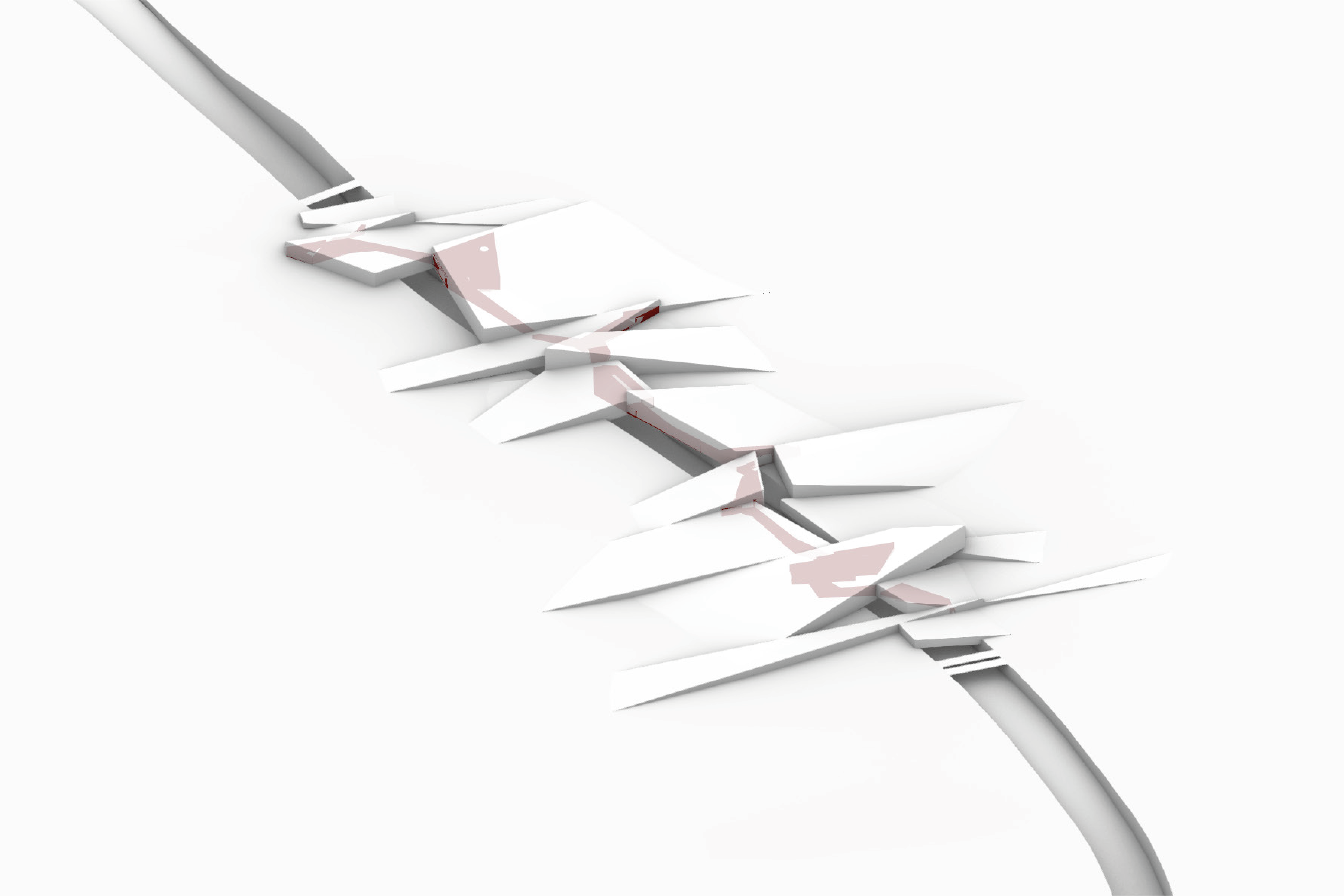
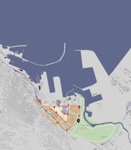
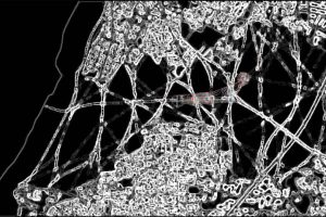
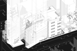
The project deals with route 531, an east-west suburban highway in the Sharon district that connects the national highways 2, 4, and 6. The highway was paved on agricultural land and has led to a spatial disconnection between Ra’anana, Givat Hen, and Herzliya due to its ground excavation and the construction of acoustic walls along both sides. Consequently, the purpose of the project is to reestablish the connection that was cut off, while still allowing the road to exist. In order to do this, the planning strategy includes the crossing of the main axes on both sides of the road so that the contour lines created for the intervention “stitch” the wound. The vertical shifting of these lines creates three-dimensional ground folds that compose new surfaces above the road that alternately cover it.
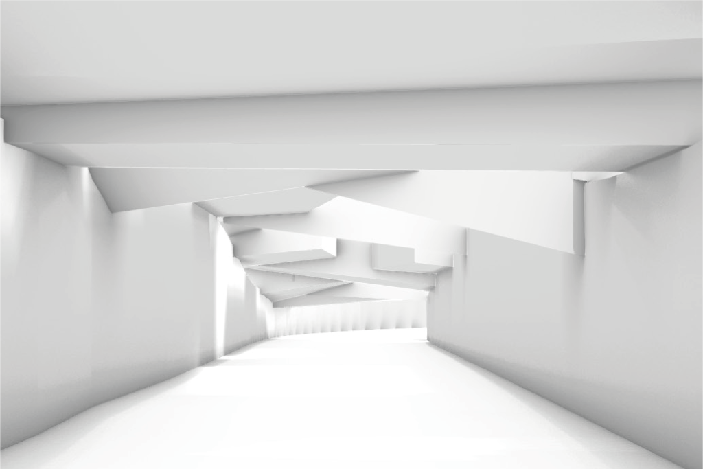
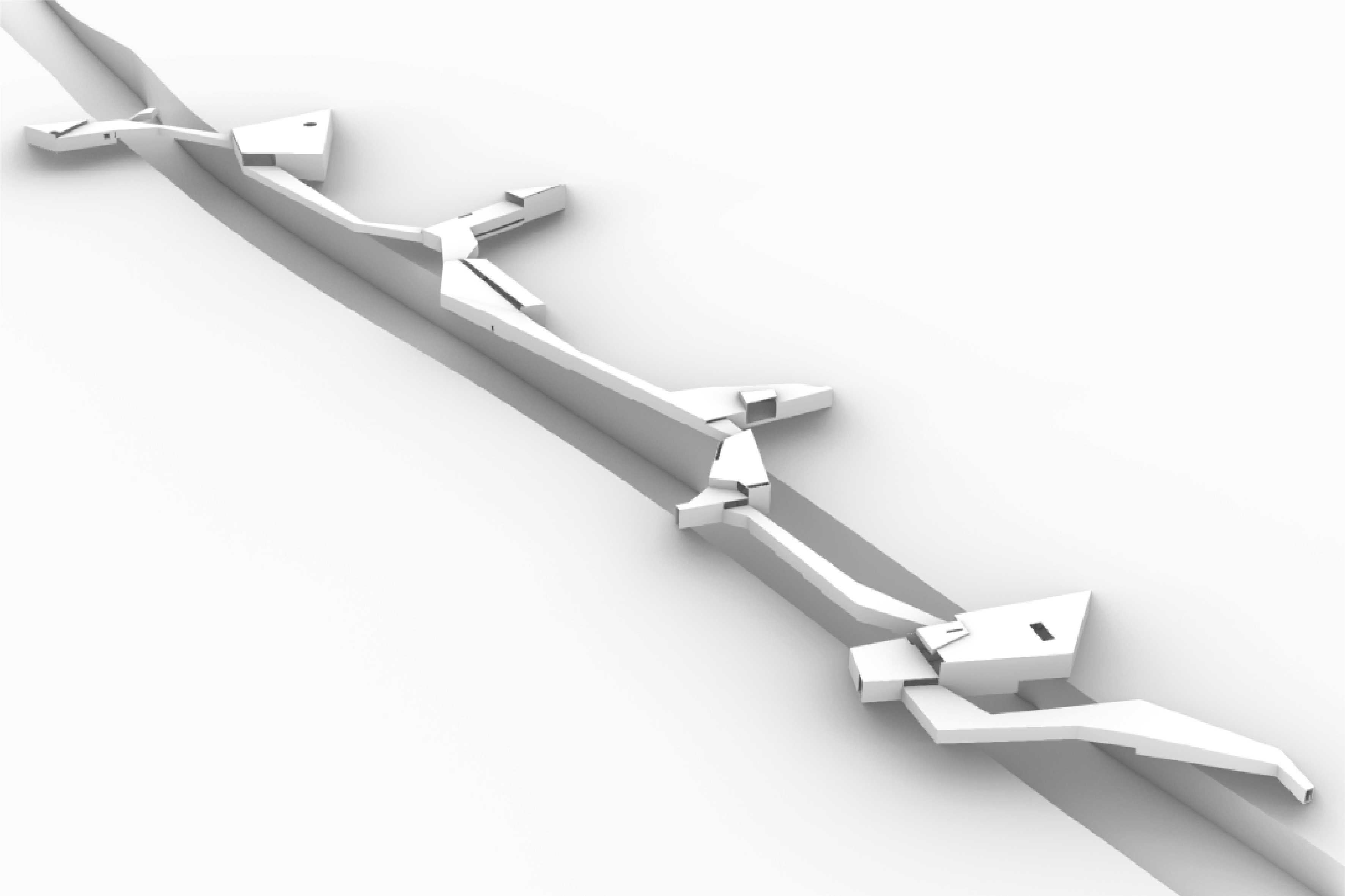
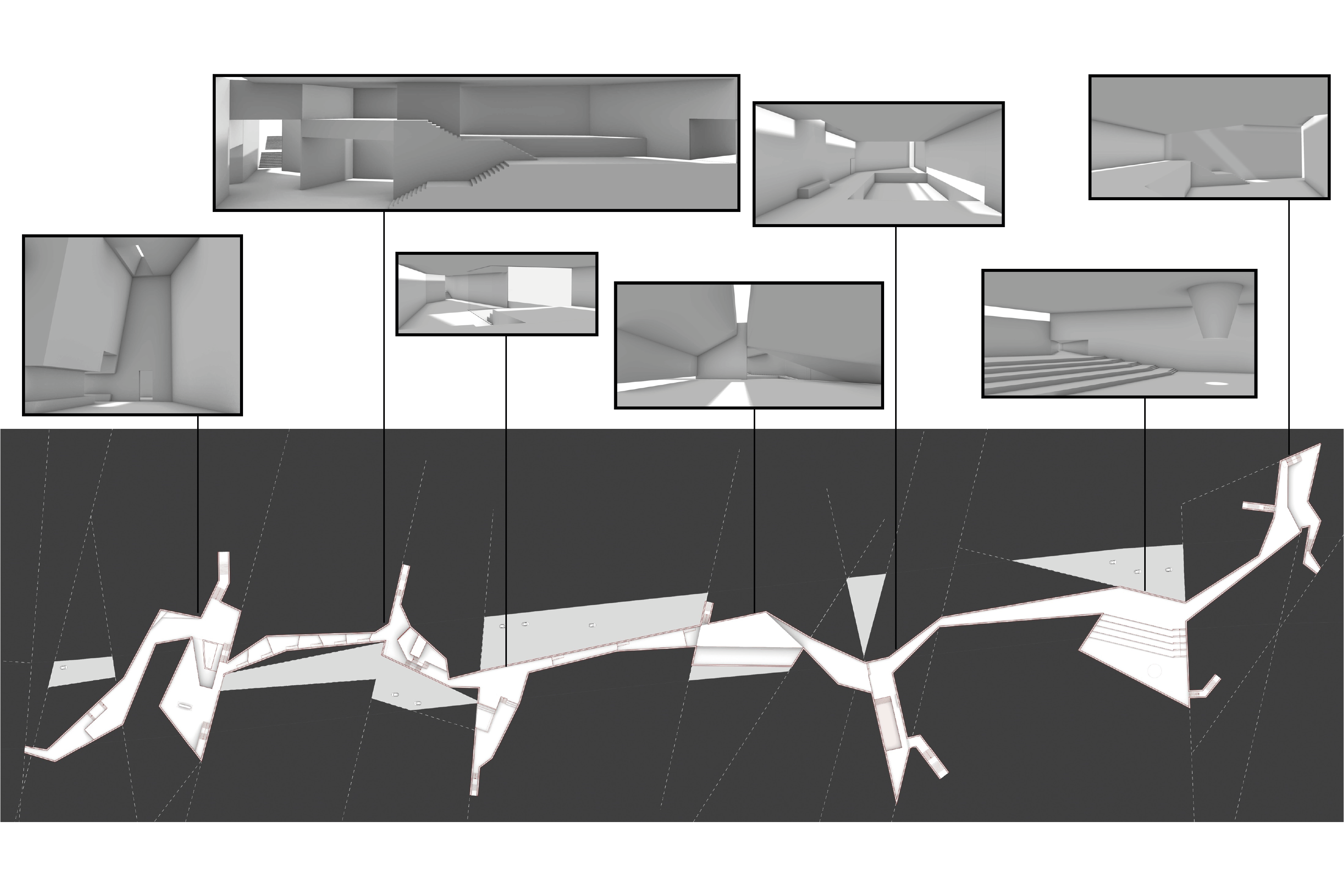
The planned composition serves as a new public space consisting of varying slopes, which both distort the space and provide a rich and diverse experience. The upper parts of the ground folds function as green roofs, and their inner parts contain a sequence of excavated and hidden spaces used for public programs, which echo the linearity of the road. Along the new environment, there are several interface points that allow the passage from one side of the road to the other, helping to heal the damaged urban fabric, both physically and metaphorically. The spatial change caused by the ground folds that cover parts of the road reflects the desire to weaken its presence in the space, and the result resembles a scar. The design changes the movement patterns in, use of, and experience in the space and serves to change the perception of the road’s identity.