![]()
![]()
![]()
![]()
![]()
![]()

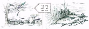
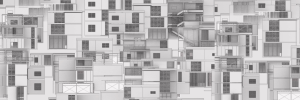
Throughout the years, the landscape of the Galilee has changed and undergone various processes of landscape formation. The project seeks to explore the effect of the geo-political elements of the landscape on the expansion and identity of the Arab towns (infrastructures, forestation, natural reserves, population settling, etc.)
The research demonstrates and concludes how these spatial elements were used to construct and alter the landscape, affecting it on a different scale, and specifically diminishing the expansion and the connection between the Arab towns. The question then arises: How can the new urban expansions, shaped by decades of landscape building, be leveraged to create a spatial system of Arab resilient towns?”
The institutional planning and the geo-political elements are an inseparable part of the landscape. The project understands their effect on the landscape and on the Arab towns. However, instead of a reversing act, the project seeks to rise from the existing situation and turn the restrictions into opportunities. Transforming the spatial elements imposed from above through the study of local modes of life and needs.
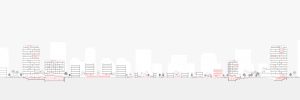
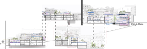
Merging the top-down and bottom-up forces, and creating a new approach to intervention, which acknowledges the segregating planning practices and allows considering alternative planning approaches – those which are politically, socially and culturally sensitive, the project focuses on the infrastructure imposed from above. This includes the light rail line (“NofIT” from Haifa to Nof-Hagalil), altering its route, stringing the Arab towns on a regional level, with its stations serving nodes that create the connection between them. The stations are situated at the heart of the new expansions on the edge of the towns, constituting focal points that challenge institutional planning and propose a new type of local public building rooted in context and identity.