![]()
![]()
![]()
![]()
![]()
![]()
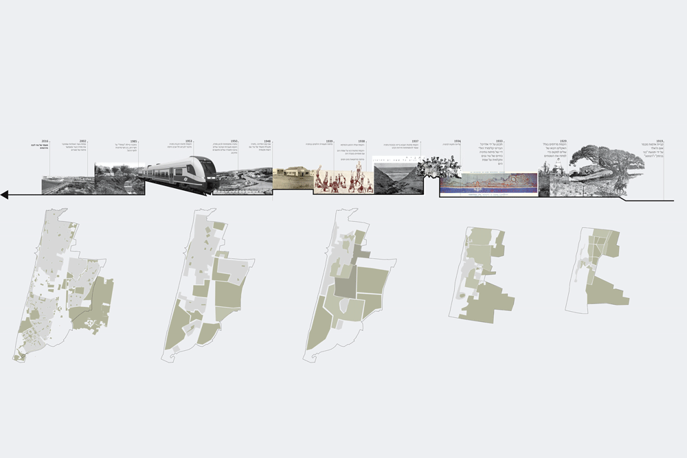
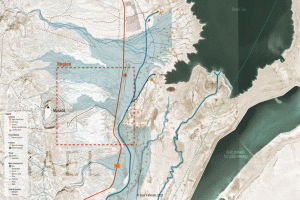
Over the years, cities have developed along Israel’s coastline, which forms its western border. This coastal area holds significant potential for economic, social, and cultural opportunities, with a connection to the sea enhancing the quality of life for residents. Their proximity to the sea heavily influenced urban planning for new cities established during the early 20th century.
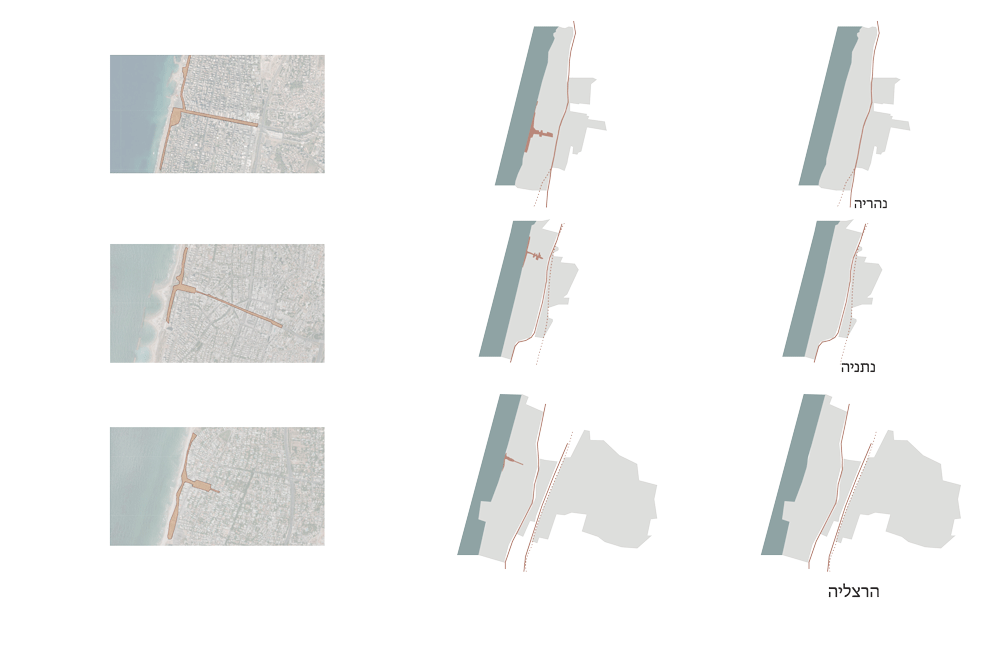
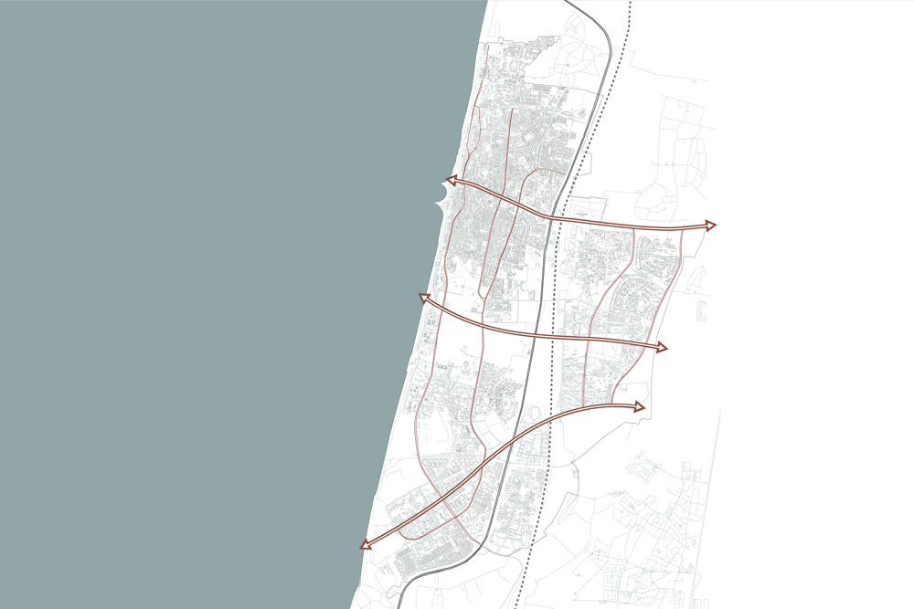
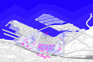
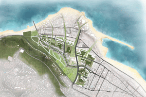
The narrow morphology of the country led to the development of infrastructure—such as national roads and railways—primarily in a north-south direction, parallel to the coastline. As coastal cities expanded, they began to encroach upon these heavy infrastructures, creating barriers that fragmented urban continuity. Consequently, the eastern parts of these cities have become disconnected from their cultural ties to the sea.
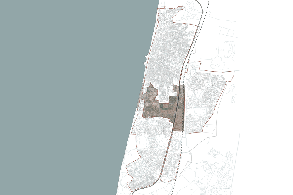
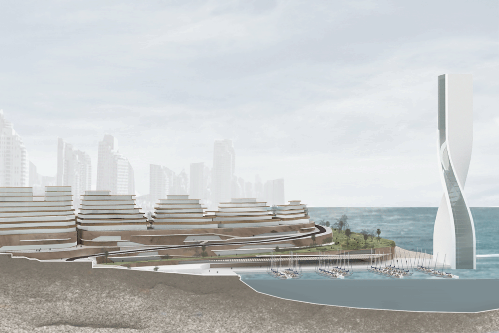
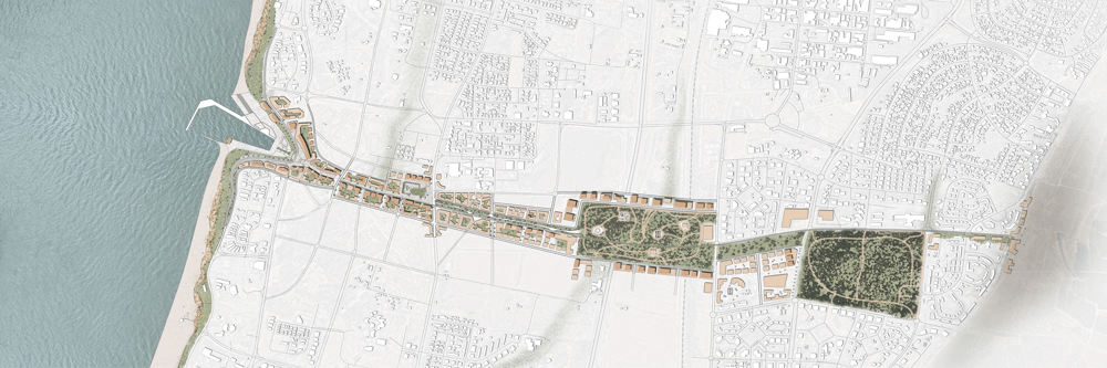
Netanya, situated on the coast in the Sharon region, exemplifies this issue: roads and railroad tracks act as barriers that disrupt the urban continuum. Additionally, the city’s unique topography is characterized by a cliff that creates a significant separation from the sea.
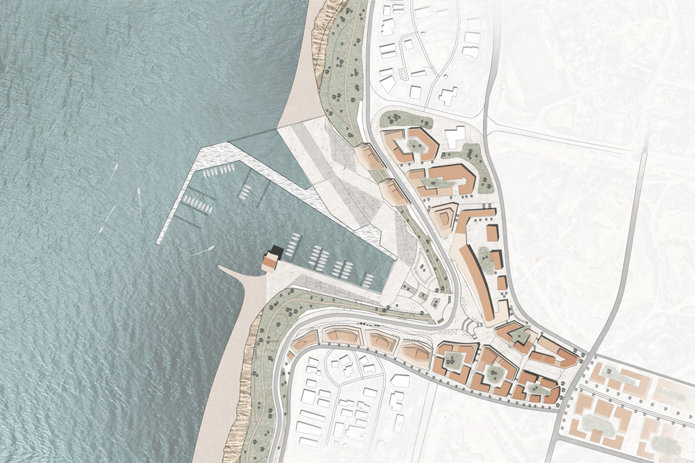
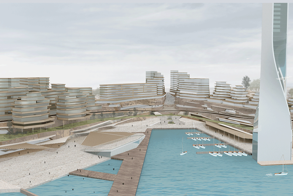
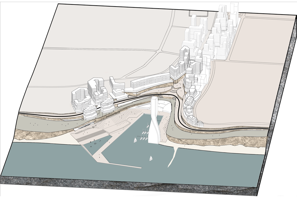
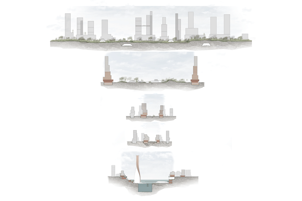
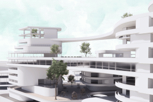
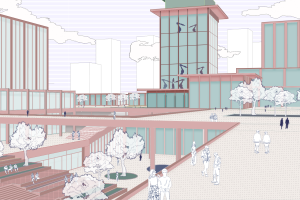
This project addresses the challenge of developing an urban model that effectively links the disparate parts of the city with the coastline. It aims to enhance local identity, which has evolved over the years, and to cater to the diverse populations residing in the city. The project will establish an axis that traverses the city from east to west, culminating in a connection to the sea. A critical focus will be the area at the end of this axis, requiring strategies to manage the cliff and facilitate a close relationship between the city and the sea.