![]()
![]()
![]()
![]()
![]()
![]()
Since the annexation of East Jerusalem, Israel has implemented policies of marginalization and exclusion against Palestinian residents, aimed at altering the city’s demographic composition and ensuring a Jewish majority. This policy is reflected in intentional urban planning designed to prevent the development of Palestinian neighborhoods, isolate them from each other, and prevent their expansion.
The various planning tools, such as the separation fence, the road network, open spaces and outposts, serve as physical barriers limiting movement and access to Palestinian neighborhoods, hindering their natural development. In addition, planning authorities refrain from preparing development plans for East Jerusalem neighborhoods and promote plans that do not meet the needs of the local population. The restricted geographic space and lack of alternative spatial options have led to the emergence of informal architecture and high population density in Palestinian neighborhoods, accompanied by a shortage of basic services. This construction, mostly initiated by the residents themselves, reflects both the struggle for existence and the manner of coping with the discriminatory policy, while also strengthening the local identity and asserting the claim to the land.
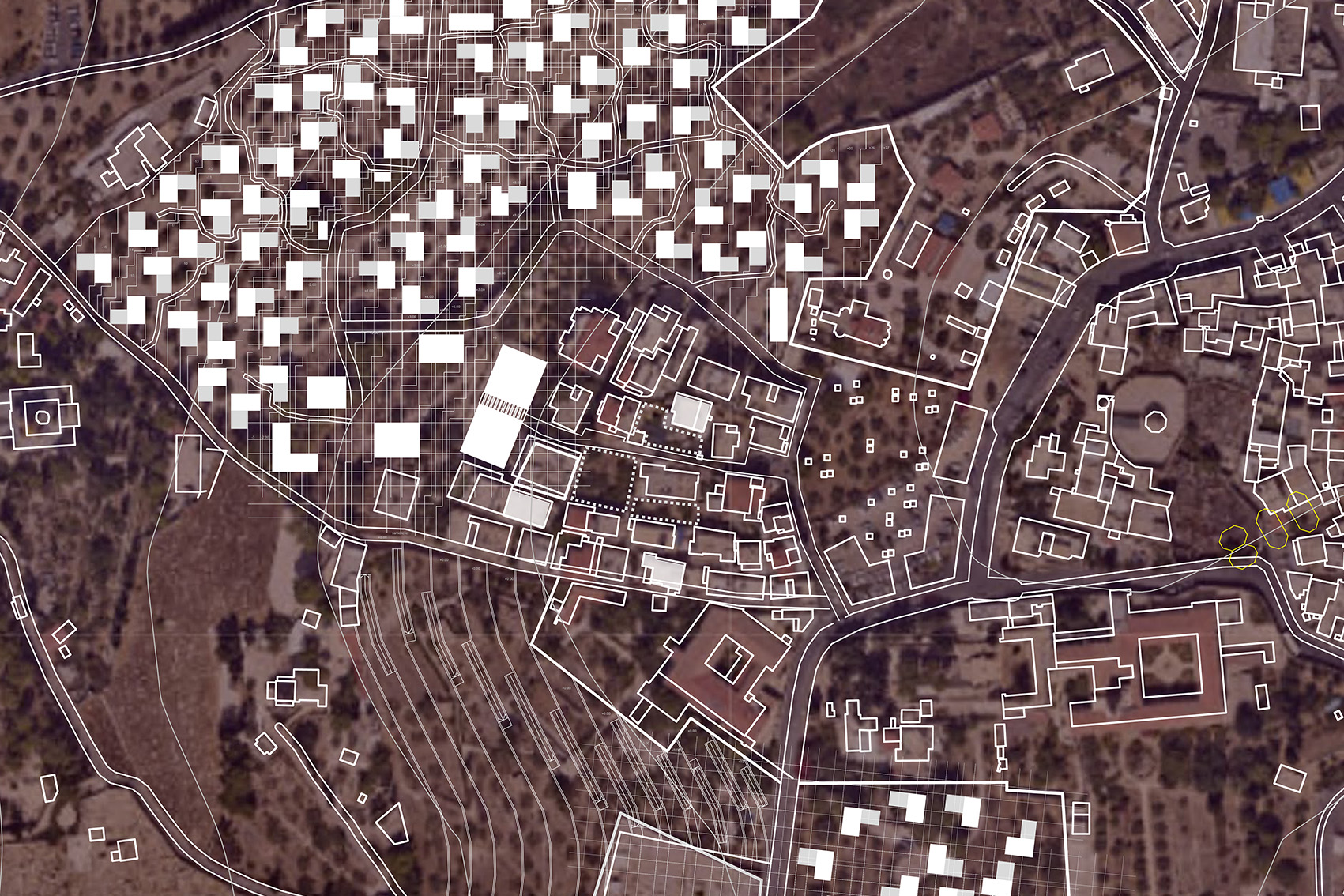
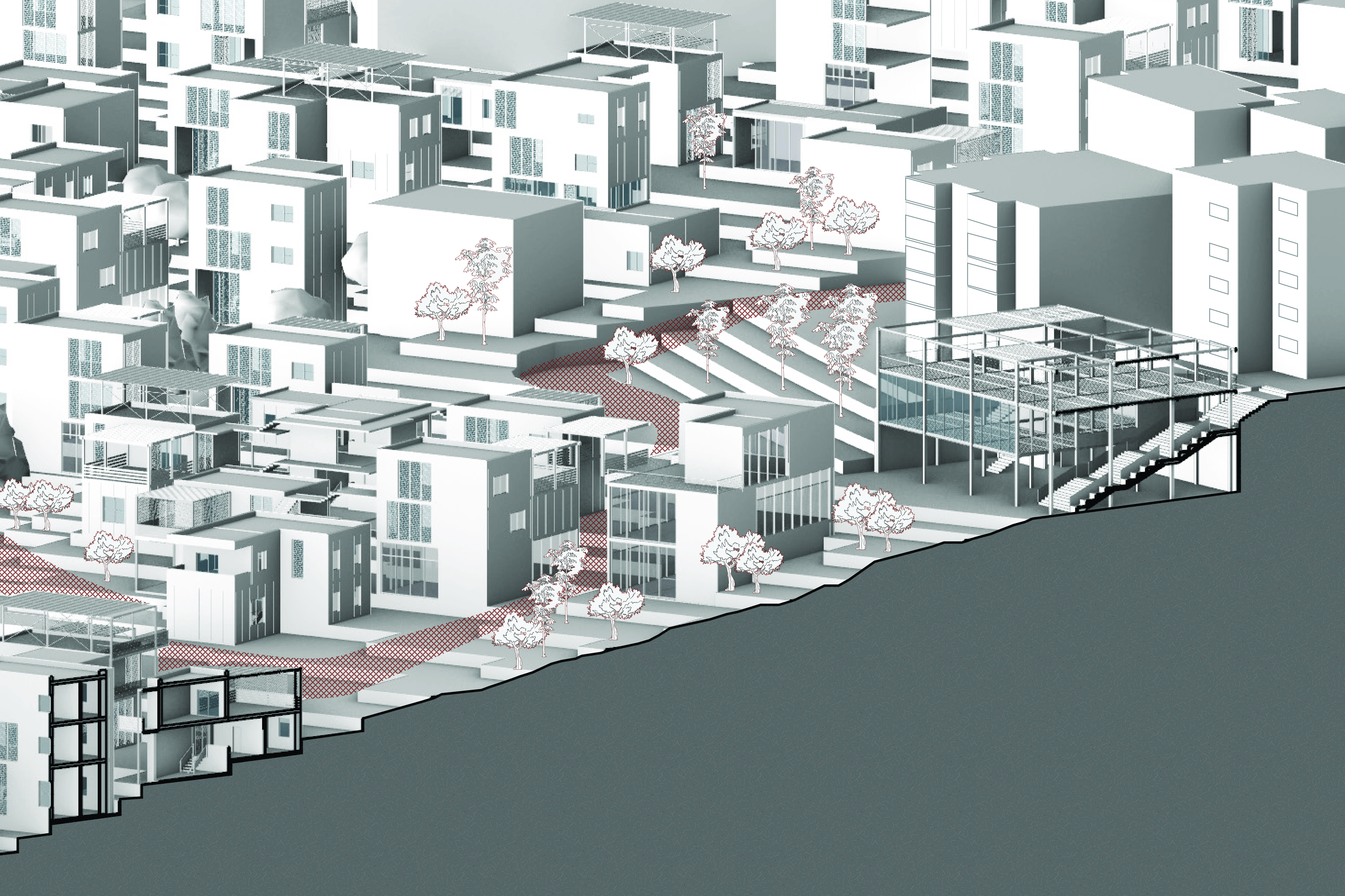
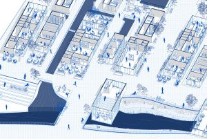
This project focuses on the neighborhood of Al-Tur as a case study of East Jerusalem’s neighborhoods. It examines how the neighborhood’s expansion can be promoted in a way that addresses the needs of the local population while resisting government policies. The project aims to develop a planning approach that ensures a suitable living environment, while recognizing the informal architecture patterns developed by the residents.
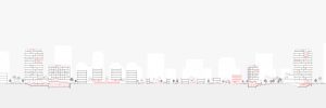
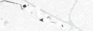
The separation fence erected east of the Al-Tur neighborhood has completed its encirclement from all directions, making it one of the most confined neighborhoods in East Jerusalem. To the north, it borders the Hebrew University campus; to the southwest, it is adjacent to the Jewish cemetery on the Mount of Olives and lands expropriated by the government and designated for various landscape purposes. All these elements act as barriers to any potential expansion of the neighborhood.
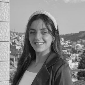
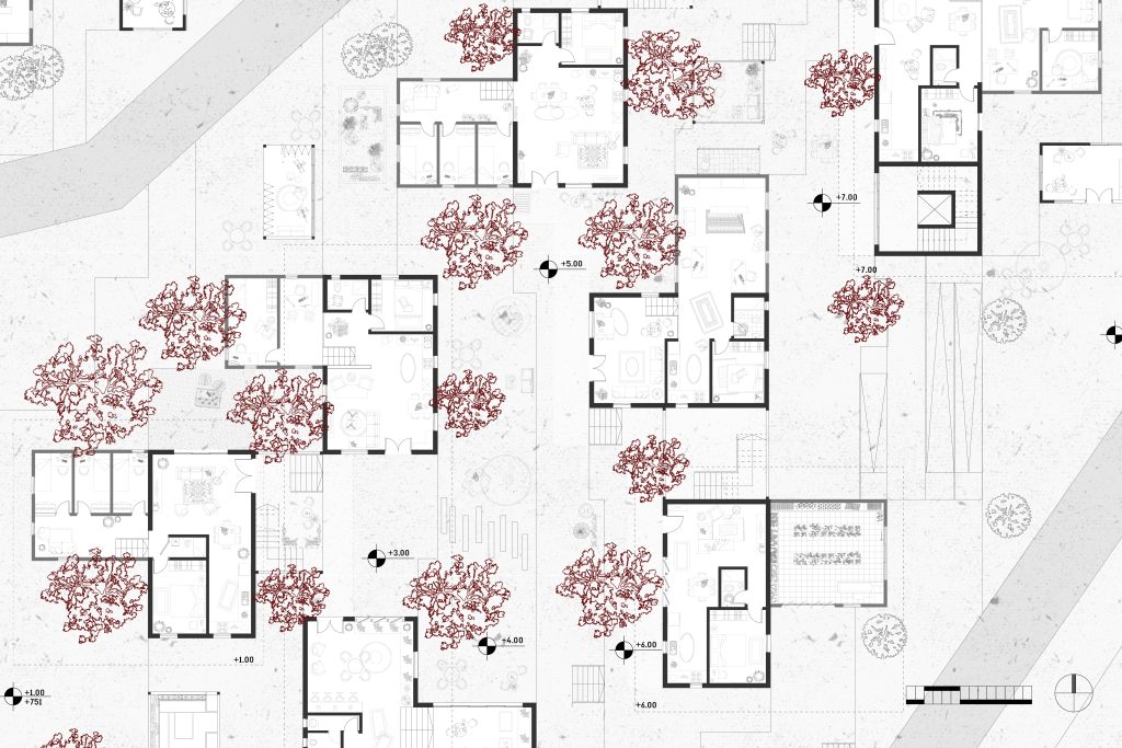
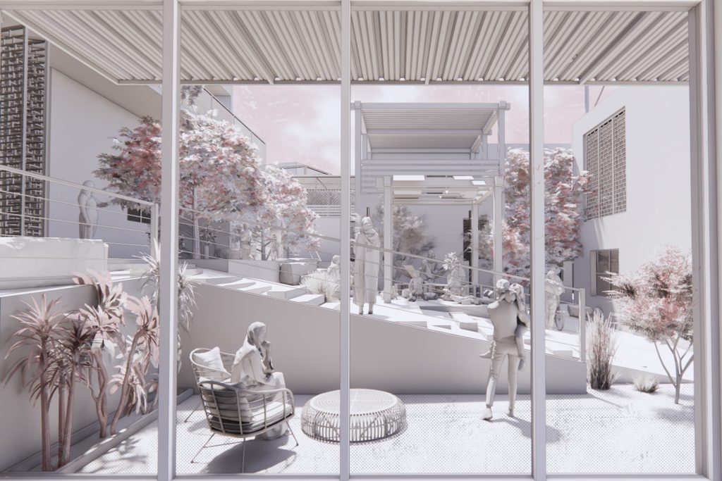
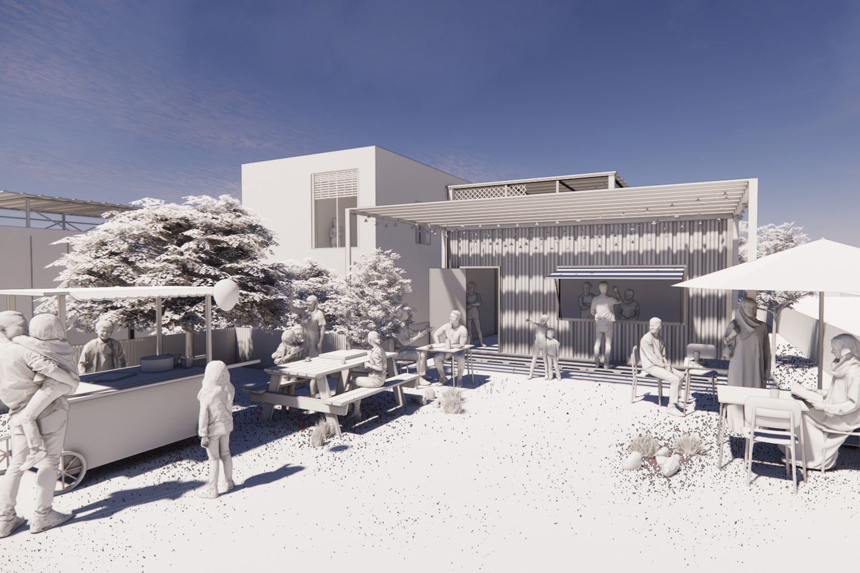
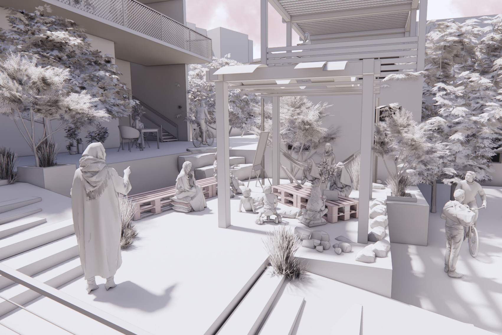
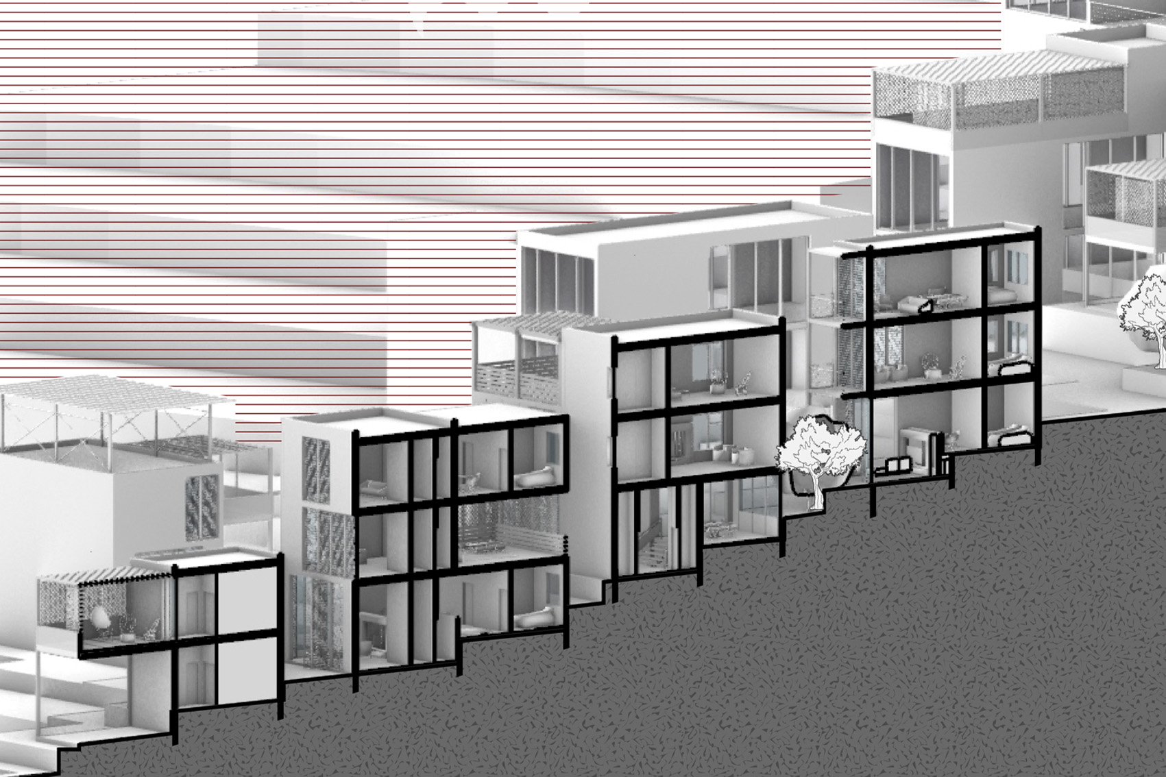
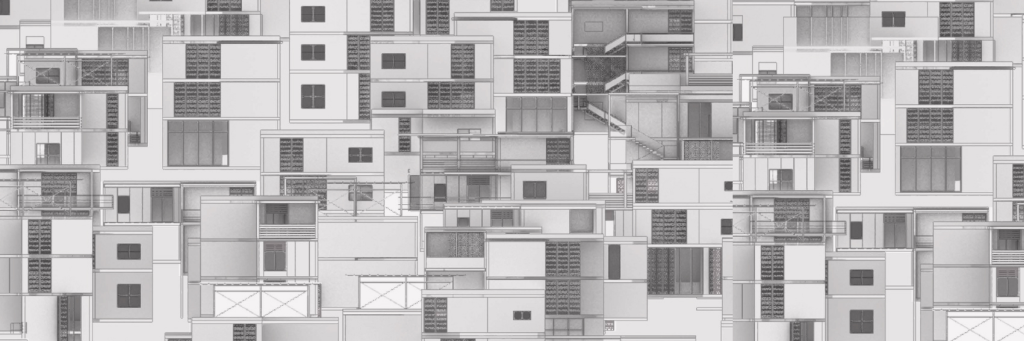
Al-Tur has transformed from a rural village into an urban neighborhood densely packed with buildings and lacking basic living conditions. Its development has been primarily led by its residents, in accordance with their evolving housing and expansion needs over the years. The residents’ actions, as bottom-up planners, are perceived as an “Architecture of Resilience” derived from geopolitical changes, although in practice, it has impacted the quality of life by reducing spaces for social activities and converting them into residential areas.
This project explores how the expansion of Al-Tur can continue along the lines of local construction patterns, acknowledging the qualities of informal space. It proposes a planning approach that integrates formal planning, which defines the boundaries of construction and expansion, with bottom-up informal planning that reflects the society, culture, and survival of the residents.