![]()
![]()
![]()
![]()
![]()
![]()
Urban Renewal of Nature and Movement in Tirat Carmel
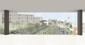
The project seeks to address the phenomenon of spatial disconnections: fractures created in the heart of the urban fabric as a result of generic modernist planning, uninspired engineering infrastructures, and natural landscapes that remain unintegrated. These disconnections stem from multiple factors: transportation infrastructure that acts as a physical barrier, topographic features that create natural separations, and urban planning that disregards the existing natural environment, sometimes giving greater weight to economic considerations. The disconnections are not only physical, but their impact is also evident in the urban social fabric. Isolated cells weaken the city’s ability to function as a living, flowing, breathing whole that interacts with its natural surroundings. A well-connected city generates functional efficiency and social and environmental resilience.
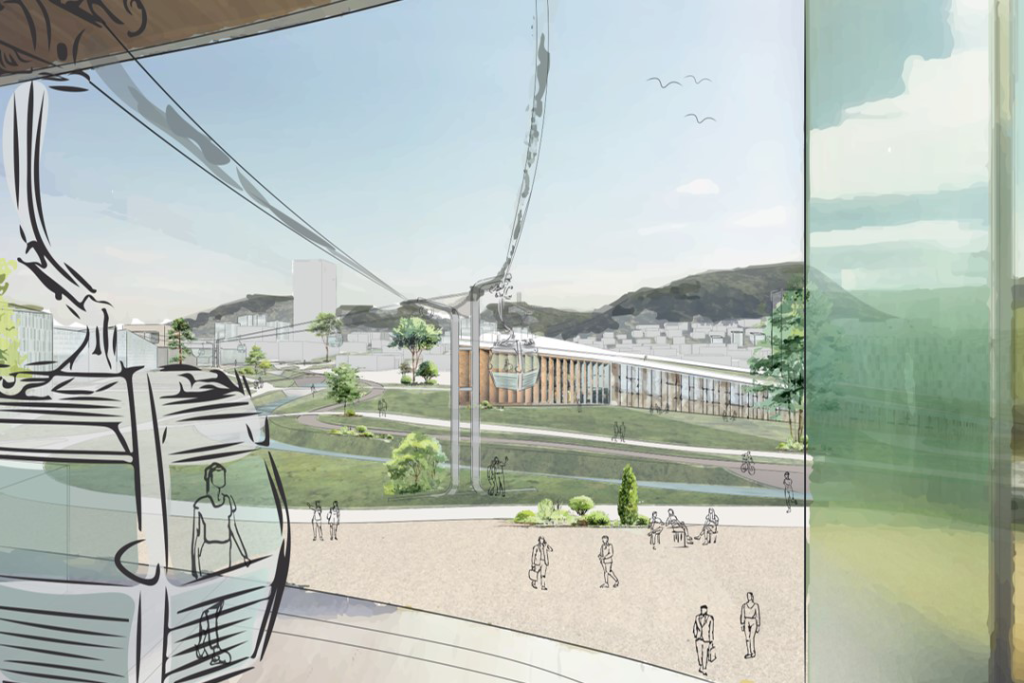
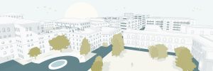
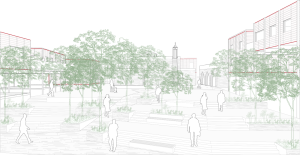
The central planning concept emerged from the space itself and its unique characteristics. Optimal urban planning, in my view, does not consist only of a functional order of buildings and infrastructure, but of a living fabric of structures, nature, movement, and people, creating spaces of flow and connectivity.
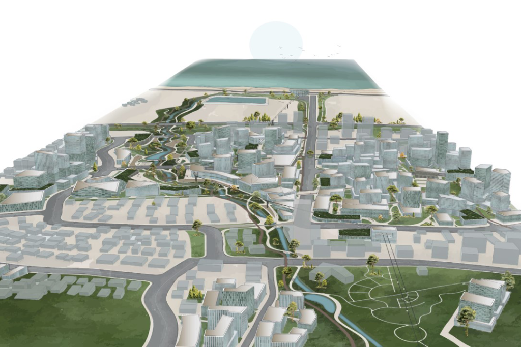
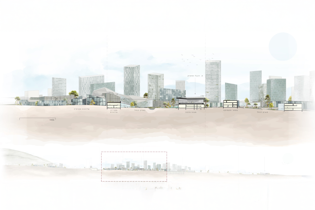
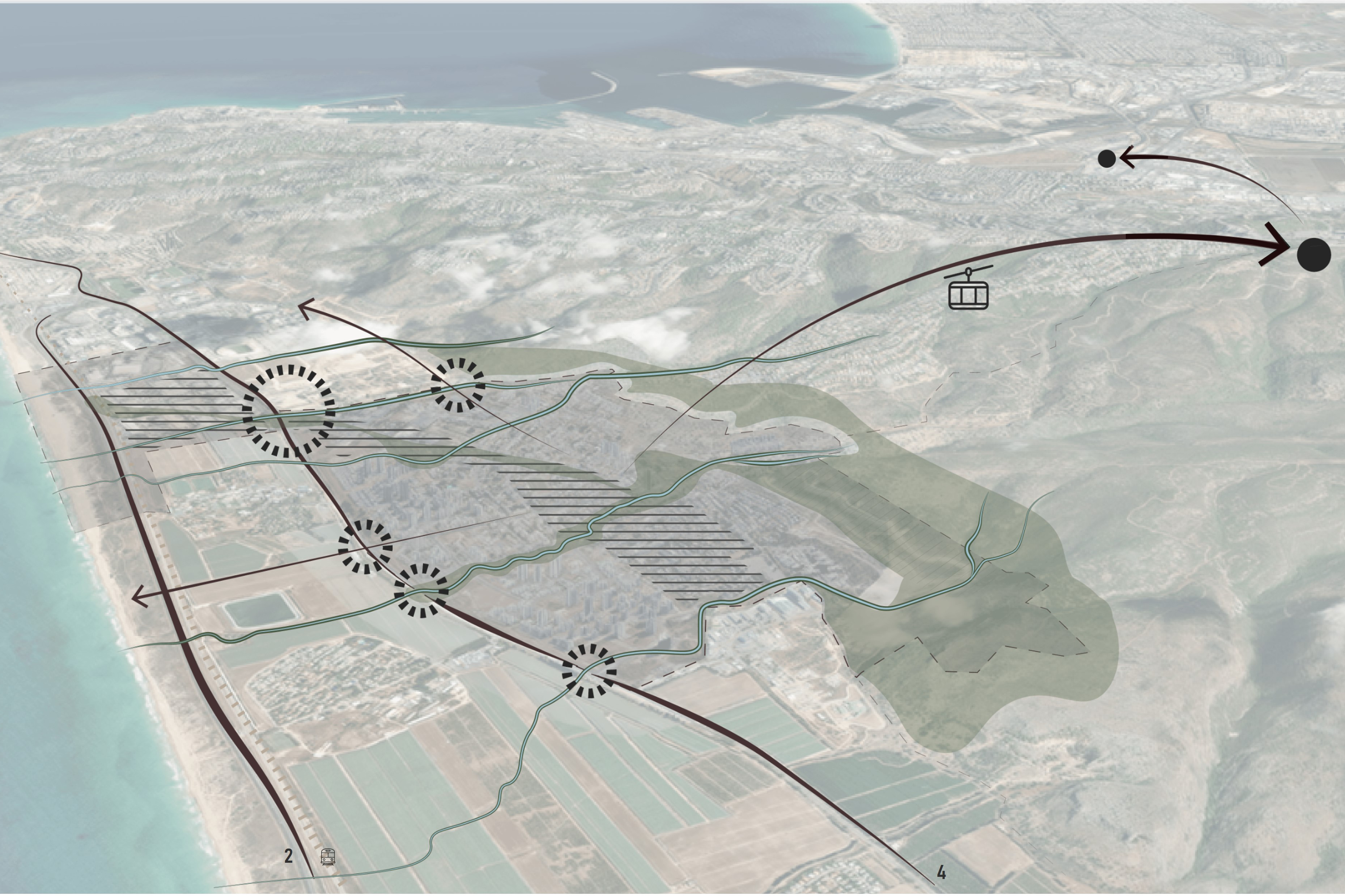
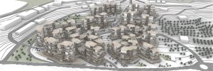
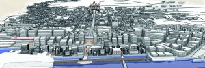
Tirat Carmel, a city situated between the mountain and the sea and adjacent to the Haifa metropolitan area, is made up of segments and, in recent years, has undergone urban renewal in several areas without an overarching vision. The city is a prime example of spatial disconnection. These stem from infrastructural barriers such as intercity highways and railway tracks, geographical barriers such as its location along the slopes of Mount Carmel, and planning barriers reflected in building patterns detached from their surroundings. Such barriers have produced physical and visual obstacles that hinder continuous movement and a holistic perception of space.
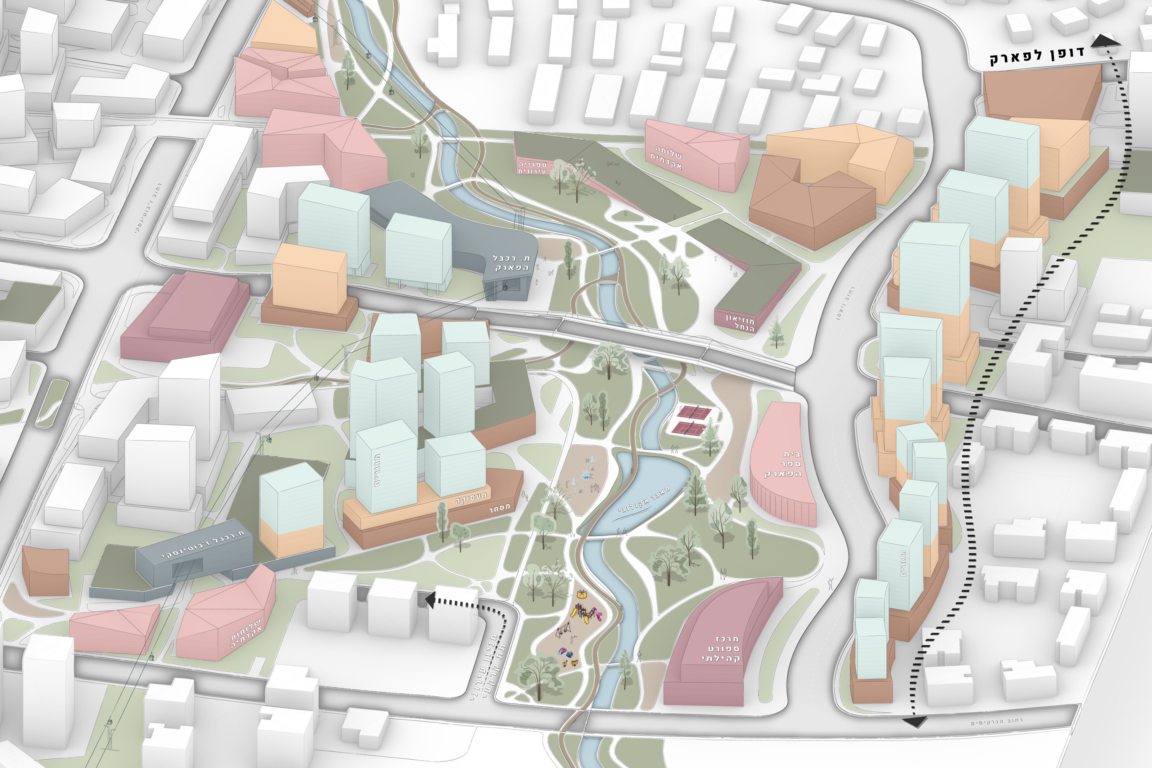
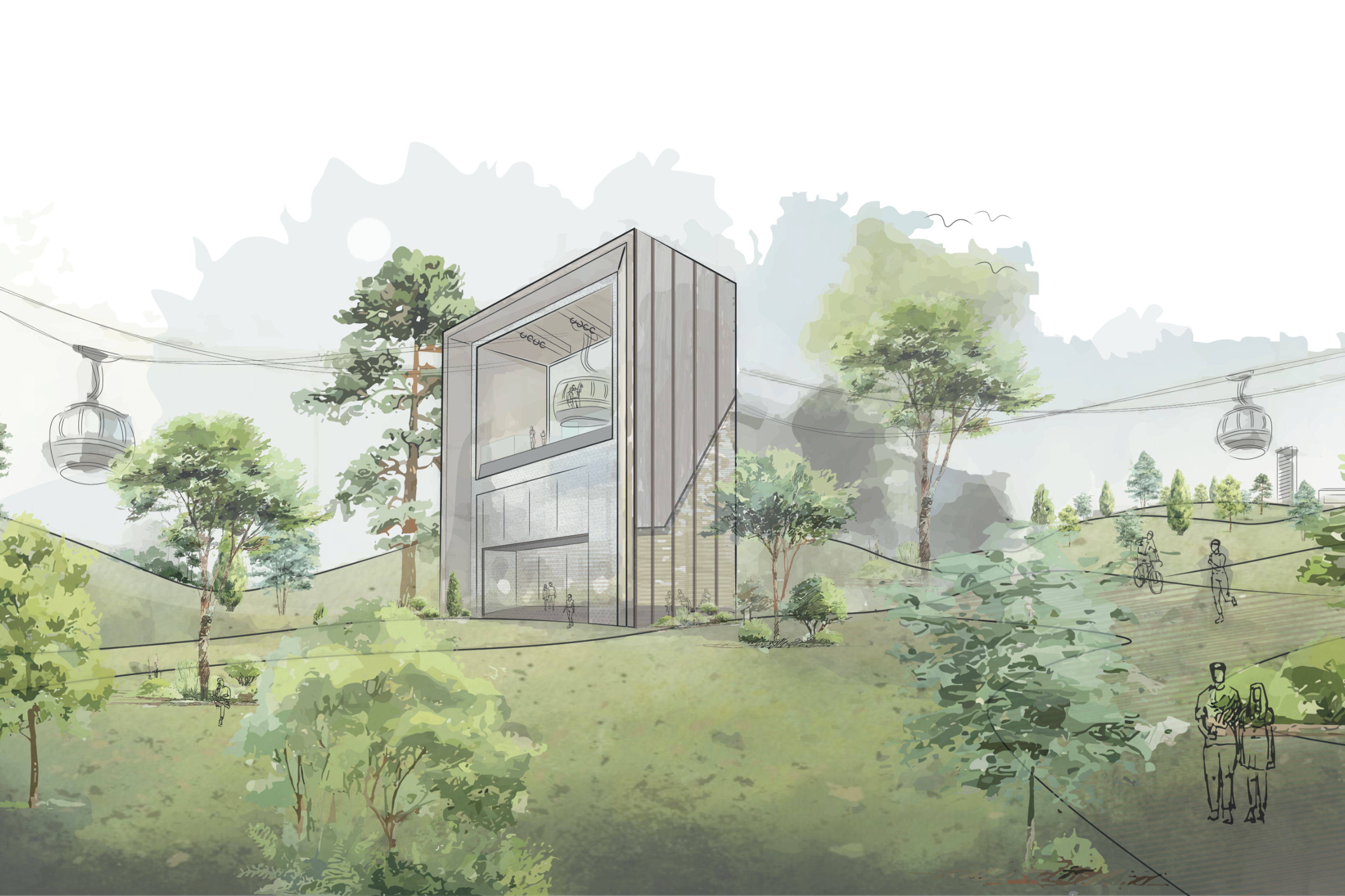
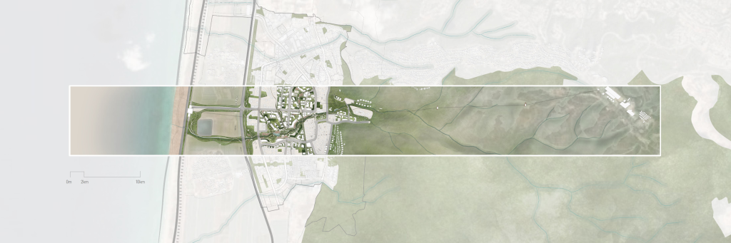
I chose to create a “strip,” a spatial corridor extending from Mount Carmel to the Mediterranean Sea, as a research tool for analyzing the existing space. Through a deep spatial reading of the city and its analysis using this strip, which encompasses all its components and environment, it was possible to examine existing disconnections and potential opportunities for connection. Using this tool, two layers were studied: the natural (topography and ecology) and the planning (infrastructure, usage patterns, and construction). Strategic intervention points were identified, and planning solutions were proposed that integrate the needs of urban and community development with the preservation of natural resources.
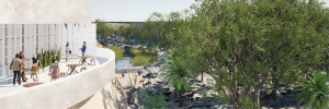
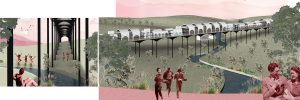
From this research emerged an intervention proposal that generates urban renewal through urban nature and a metropolitan transportation system as a strategic move. This strengthens and enriches existing natural resources, reconnects the city’s various parts, creates pathways for life, wandering, pausing, and meeting, and fosters connectivity with nature and the surrounding environment.